


Col du Chaussy - L'Armela

Bogapuki
User
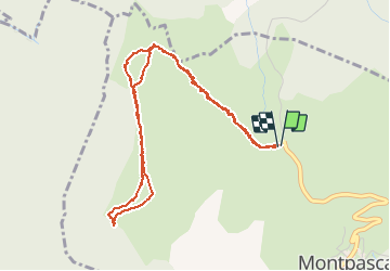

Length
5.2 km

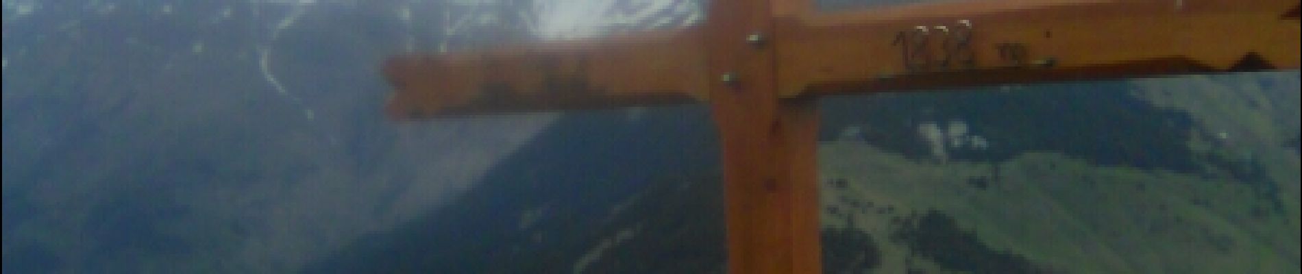
Max alt
1833 m

Uphill gradient
296 m
Km-Effort
9.1 km

Min alt
1534 m

Downhill gradient
296 m
Boucle
Yes
Creation date :
2018-11-25 09:18:59.45
Updated on :
2018-11-25 09:18:59.45
2h30
Difficulty : Easy

FREE GPS app for hiking
 SityTrail
IGN / Geographical institutes
SityTrail Plus
The world is yours!
About
Trail Other activity of 5.2 km to be discovered at Auvergne-Rhône-Alpes, Savoy, La Tour-en-Maurienne. This trail is proposed by Bogapuki.
Description
18 mai 2017
Rando agréable avec un magnifique panorama
Photos

Positioning
Country:
France
Region :
Auvergne-Rhône-Alpes
Department/Province :
Savoy
Municipality :
La Tour-en-Maurienne
Location:
Pontamafrey-Montpascal
Start:(Dec)
Start:(UTM)
292871 ; 5024555 (32T) N.
Comments